Envío a todo Costa Rica por solo ₡1490 

Enviar a
Costa Rica
0
  • argentina
  • chile
  • colombia
  • españa
  • méxico
  • perú
  • estados unidos
  • internacional

Selecciona tu país

América

Europa

Resto del mundo

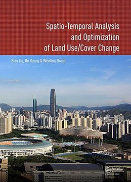
portada Spatio-Temporal Analysis and Optimization of Land Use/Cover Change: Shenzhen as a Case Study (en Inglés)
Formato
Libro Físico
Editorial
Año
2017
Idioma
Inglés
N° páginas
198
Encuadernación
Tapa Dura
ISBN13
9781138033153
N° edición
1

Spatio-Temporal Analysis and Optimization of Land Use/Cover Change: Shenzhen as a Case Study (en Inglés)

Wenting Zhang (Autor) · Bo Huang (Autor) · Biao Liu (Autor) · CRC Press · Tapa Dura

Spatio-Temporal Analysis and Optimization of Land Use/Cover Change: Shenzhen as a Case Study (en Inglés) - Liu, Biao ; Huang, Bo ; Zhang, Wenting

Libro Nuevo Importado
Envío: 4 a 5 días háb.
₡ 157.831
Costos de importación y 13% IVA incluídos en el precio ✅
Libro Nuevo

Quedan 10 unidades

₡ 157.831
Llega entre el 21 Ago y el 26 Ago a Costa Rica. Seleccionar ubicación

Reseña del libro "Spatio-Temporal Analysis and Optimization of Land Use/Cover Change: Shenzhen as a Case Study (en Inglés)"

This book proposes a method to solve land use problems, and has made some significant contributions to the land use analysis and optimization study fields. Firstly, three spatio-temporal logit models for land use change analysis, namely, geographically and temporally weighted logit model (GTWLM), spatio-temporal panel logit model (ST-PLM) and generalized spatio-temporal logit model (GSTLM), are proposed. GTWLM, which considers spatio-temporal non-stationarity, includes temporal data in a spatio-temporal framework by proposing a spatiotemporal distance. ST-PLM incorporates the spatio-temporal correlation and individual effect in one model. By integrating GTWLM and ST-PLM, the GSTLM explores spatio-temporal non-stationarity and correlations simultaneously, whilst considering their individual effects to construct an integrated model. Secondly, a MOO-based two-level spatial planning of land use is proposed. The spatial planning aims at managing and coordinating the land use at different geographic extents and involves spatial layouts and structures of land use at different levels. In spatial planning, GIS and Remote Sensing are used to evaluate, analyze, and measure environmental, economic and social issues. The quantitative relationships between these objectives and spatial land use allocation are then used as rules in the MOO process to simulate environmental conditions under different spatial land use allocation scenarios. The book features a case study of Shenzhen city, the most important Special Economic Zone in China.This book will be of interest to academics and professionals in the fields of urban planning, land resource management, remote sensing and geographic information systems.

Opiniones del libro

Preguntas frecuentes sobre el libro

Todos los libros de nuestro catálogo son Originales.
El libro está escrito en Inglés.
La encuadernación de esta edición es Tapa Dura.

Preguntas y respuestas sobre el libro

¿Tienes una pregunta sobre el libro? Inicia sesión para poder agregar tu propia pregunta.

Opiniones sobre Buscalibre

Ver más opiniones de clientes